

Park access
Google Maps showed closing at 22:00 when checked on 2026-10-30. This is not a weekly schedule confirmed by the City and does not apply to the dome, lift or restaurants. Confirm park access before setting out.
A Coruña · Galicia · Atlantic
A park above A Coruña’s Atlantic coast, with outdoor viewpoints and reminders of a former coastal battery. Distinguish the park visit from Cúpula Atlántica and the closed lift: their access conditions do not necessarily coincide.
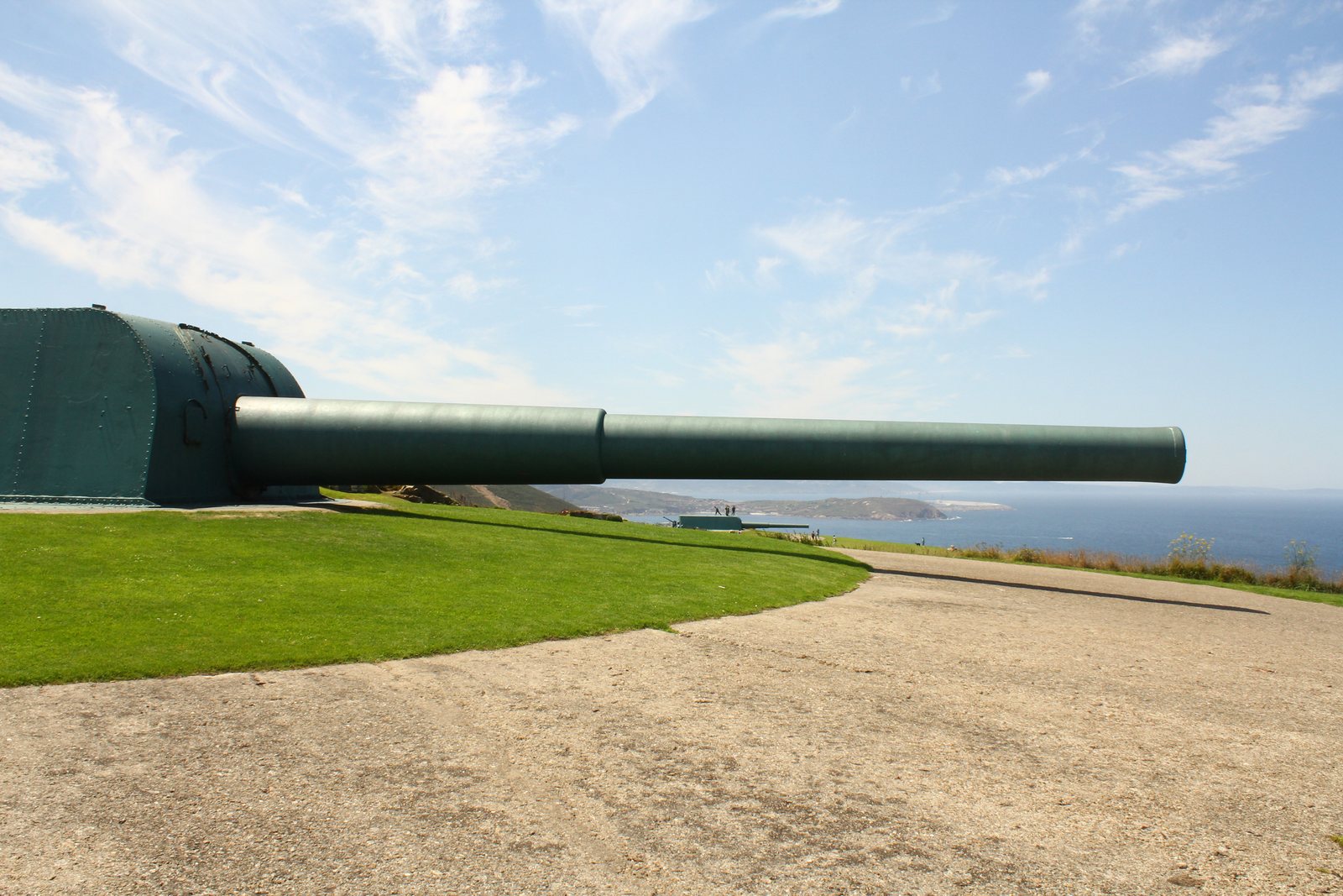
Contando Estrelas · 2015-08-02 · Source · CC BY-SA 2.0. Historical photograph; resized and recompressed, display crop varies with device.
Manual Google Maps snapshot dated 2026-10-30: 4.7/5 and 12,458 reviews. It does not update automatically; these are not reviews collected here. · See all reviews on Google Maps ↗
Sea, city & Costa Ártabra
This review did not verify a current municipal general-admission tariff. Confirm access conditions; services and venues may have separate charges.
About this place
A park above A Coruña’s Atlantic coast, with outdoor viewpoints and reminders of a former coastal battery. Distinguish the park visit from Cúpula Atlántica and the closed lift: their access conditions do not necessarily coincide.
Google Maps showed closing at 22:00 when checked on 2026-10-30. This is not a weekly schedule confirmed by the City and does not apply to the dome, lift or restaurants. Confirm park access before setting out.
Maps marked an accessible entrance on 2026-10-30. That is not a survey of every path, slope, toilet or temporary obstruction. With the lift closed, confirm an entrance suited to your needs.
About this place
Manual Google Maps snapshot dated 2026-10-30: 4.7/5 and 12,458 reviews. It does not update automatically; these are not reviews collected here. · See all reviews on Google Maps ↗
From defence to promenade
A Coruña Tourism dates the conversion of the former defensive site into a park to 1999. Its two Vickers guns were acquired in 1929 and installed in 1933.
Visit plan
Google Maps showed closing at 22:00 when checked on 2026-10-30. This is not a weekly schedule confirmed by the City and does not apply to the dome, lift or restaurants. Confirm park access before setting out.
A Coruña Tourism identifies Cúpula Atlántica as a covered viewpoint. Current hours, admission, exhibitions and activities were not verified: confirm its opening separately rather than applying park hours to it.
The municipal tourism page checked on 2026-10-30 says the lift is temporarily closed. Do not rely on it to ascend or descend. No reopening date has been verified.
This review did not verify a current municipal general-admission tariff. Confirm access conditions; services and venues may have separate charges.
This guide has no live weather feed. Check MeteoGalicia forecasts and warnings; wind, rain and visibility can change your plan. Respect barriers and closures and keep away from edges.
Maps marked an accessible entrance on 2026-10-30. That is not a survey of every path, slope, toilet or temporary obstruction. With the lift closed, confirm an entrance suited to your needs.
The viewpoint
Outdoor viewpoints offer views of the coast and city when visibility allows. Clear views are not guaranteed from every location.
To the west, on clear days, the horizon reaches the Sisargas Islands and the coast of Arteixo; to the east A Coruña opens up, with the Torre de Hércules and the Paseo Marítimo as unmistakable references.
A Coruña's Atlantic façade, with beaches, surf and, weather permitting, the Sisargas Islands in the distance.
The urban centre, the port and the Costa Ártabra unfold to the east.
Cúpula Atlántica
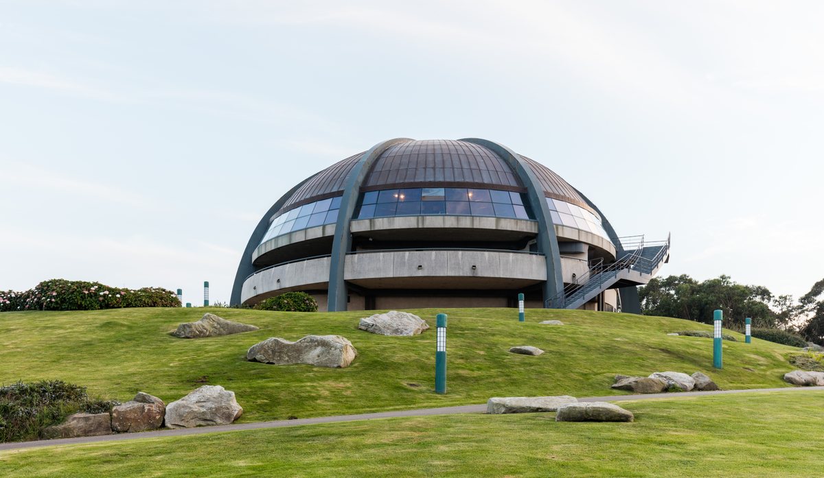
A Coruña Tourism identifies Cúpula Atlántica as a covered viewpoint. Current hours, admission, exhibitions and activities were not verified: confirm its opening separately rather than applying park hours to it.
Google Maps showed closing at 22:00 when checked on 2026-10-30. This is not a weekly schedule confirmed by the City and does not apply to the dome, lift or restaurants. Confirm park access before setting out.
Sources checked and manual snapshot: 2026-10-30.
Important notice
The municipal tourism page checked on 2026-10-30 says the lift is temporarily closed. Do not rely on it to ascend or descend. No reopening date has been verified.
Old lift fares or timetables are not operating information.
Sources checked and manual snapshot: 2026-10-30.
Location & mobility
Maps lists Estrada Os Fortes, 7, 15011 A Coruña as a place reference, not a verified exact entrance. Open the listing and confirm the route and entrance before travelling.
Check current routes, stops and schedules with Compañía de Tranvías. This guide does not confirm a particular bus route or walking time from each stop.
Maps marked an accessible entrance on 2026-10-30. That is not a survey of every path, slope, toilet or temporary obstruction. With the lift closed, confirm an entrance suited to your needs.
This guide has no live weather feed. Check MeteoGalicia forecasts and warnings; wind, rain and visibility can change your plan. Respect barriers and closures and keep away from edges.
For official data and regional tourist information, see the Turismo da Coruña · España / Galicia ↗ · A Coruña / Galicia ↗
Around
A Coruña Tourism names Árbore da Veira as a restaurant at the top of the hill.
The same municipal portal names Taberna 5 Mares as a more informal dining option.
Current trading, menus, reservations and access for these venues were not independently confirmed; check directly before visiting.
The city’s coastal promenade; choose a section and confirm its route and climb to the park.
A lighthouse and separate A Coruña destination. Consult its own municipal page for access, tickets and hours.
Maps snapshot
4.7 / 5
12,458 reviews · Google Maps
Manual Google Maps snapshot dated 2026-10-30: 4.7/5 and 12,458 reviews. It does not update automatically; these are not reviews collected here.
FAQ
Google Maps showed closing at 22:00 when checked on 2026-10-30. This is not a weekly schedule confirmed by the City and does not apply to the dome, lift or restaurants. Confirm park access before setting out.
The municipal tourism page checked on 2026-10-30 says the lift is temporarily closed. Do not rely on it to ascend or descend. No reopening date has been verified.
A Coruña Tourism identifies Cúpula Atlántica as a covered viewpoint. Current hours, admission, exhibitions and activities were not verified: confirm its opening separately rather than applying park hours to it.
This review did not verify a current municipal general-admission tariff. Confirm access conditions; services and venues may have separate charges.
Maps lists Estrada Os Fortes, 7, 15011 A Coruña as a place reference, not a verified exact entrance. Open the listing and confirm the route and entrance before travelling.
Maps marked an accessible entrance on 2026-10-30. That is not a survey of every path, slope, toilet or temporary obstruction. With the lift closed, confirm an entrance suited to your needs.
Check current routes, stops and schedules with Compañía de Tranvías. This guide does not confirm a particular bus route or walking time from each stop.
Manual Google Maps snapshot dated 2026-10-30: 4.7/5 and 12,458 reviews. It does not update automatically; these are not reviews collected here.
Sources & updates
Sources cover different subjects: the City describes history and facilities, the operator publishes transport information, and MeteoGalicia provides warnings. Check current conditions for each service.
Sources checked and manual snapshot: 2026-10-30.
